Problem Statement : To spot a target amongst a clutter of different objects spread randomly over a grassy land and subsequently communicate the location of the target to their remaining two drones using swarm technology only.
Motivation : This type of project finds it’s applications in Search and Rescue type of mission, Agricultural Field Scan, etc. We also extended this project further to detect Human Mannequin [Army Fatigue], to make the project more useful in general scenario. We also implemented and tested several SWARM communication methodology such as Multimaster_fkie, Ad-Hoc and OSLR. The project was integrated with a html-based live interactive map update service to show the real-time location of UAV agents and detected targets on an Map API.
One may find the Project Report, Presentation, GitHub : Open Source and Documented Code, Setup Information, Testing Videos, and some other information regarding the project, below.
Test Run of SWARM UAV Search Operation for D.R.D.O. UAV Fleet Challenge. Problem Statement: To scan and search for described targets in a given arena, using SWARM of UAV agents, fully autonomously. What’s happening in the video: The Agents Takeoff autonomously and move towards the most optimum location for conducting a low-level scan from a higher height. They identify the region of interest (probable targets) and calculate an optimal Multi-goal Hamiltonian path to travel to these expected targets and determine true-positives (eliminating false-positives identified in the previous step).
** THIS ORIGINAL PROJECT WAS MOVED TO THIS NEW REPOSITORY. THE DOCUMENTATION WILL BE UPDATED BY END OF FEBRUARY, 2020 **
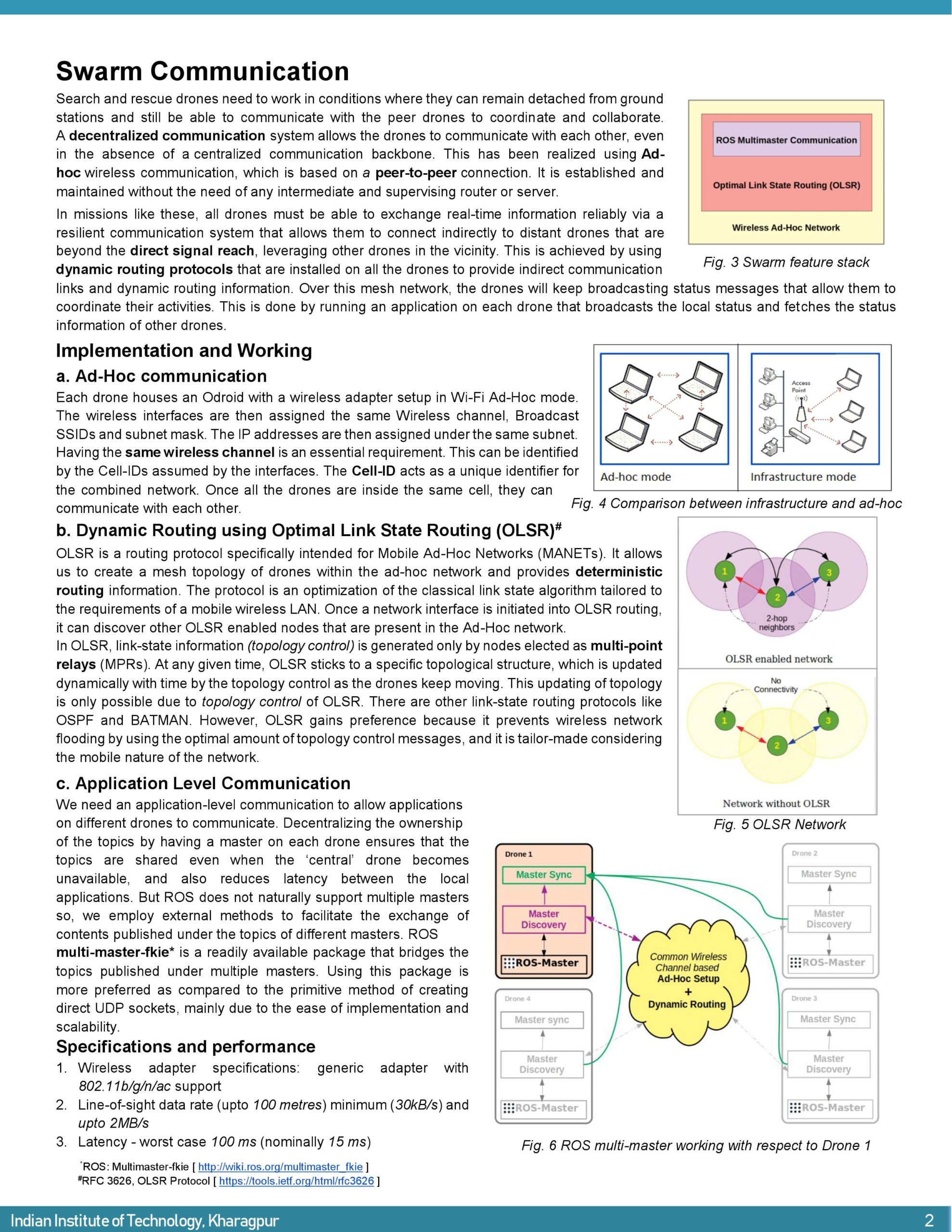
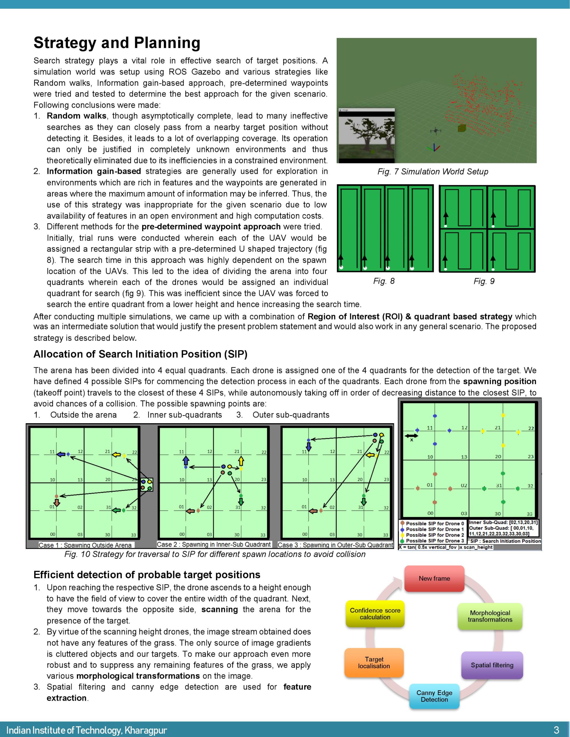
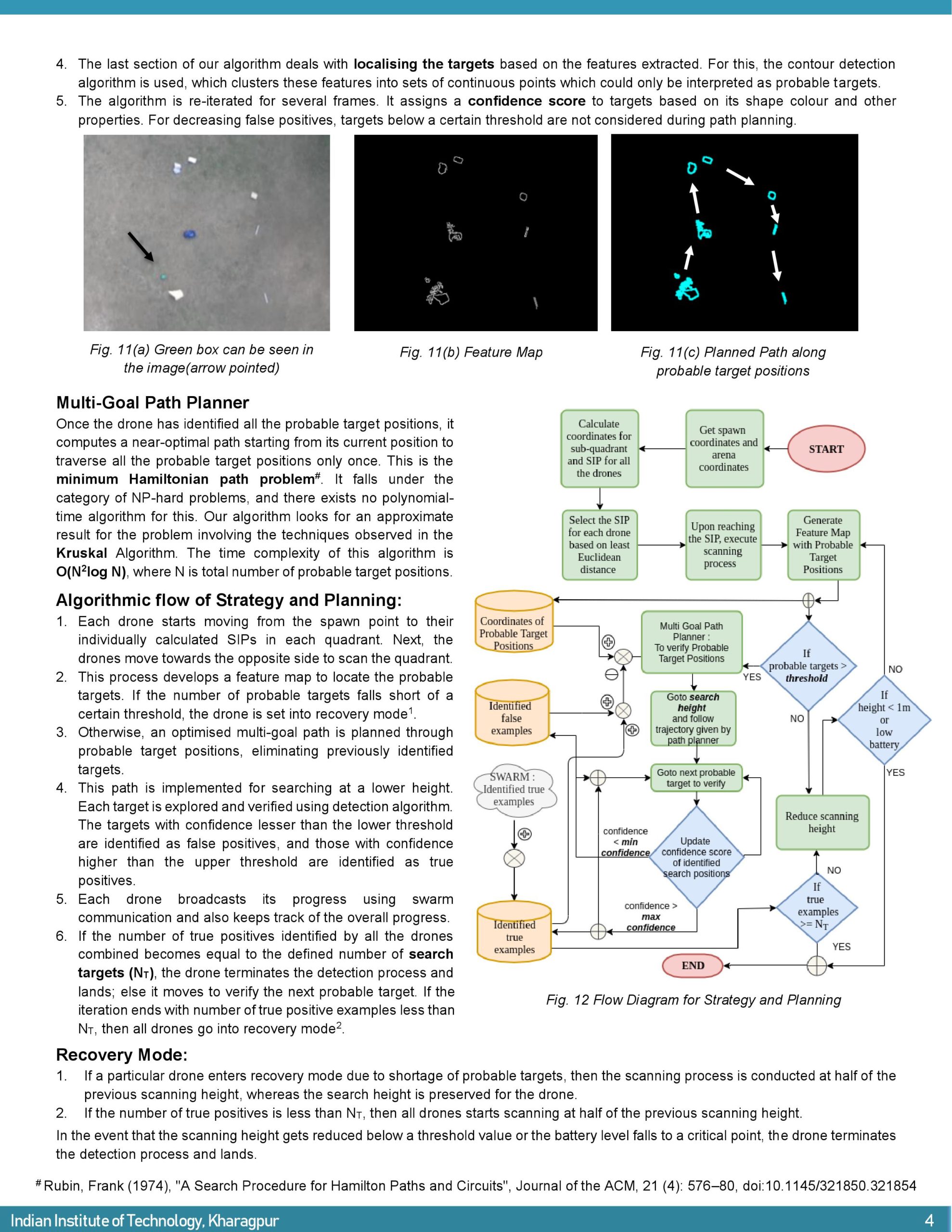
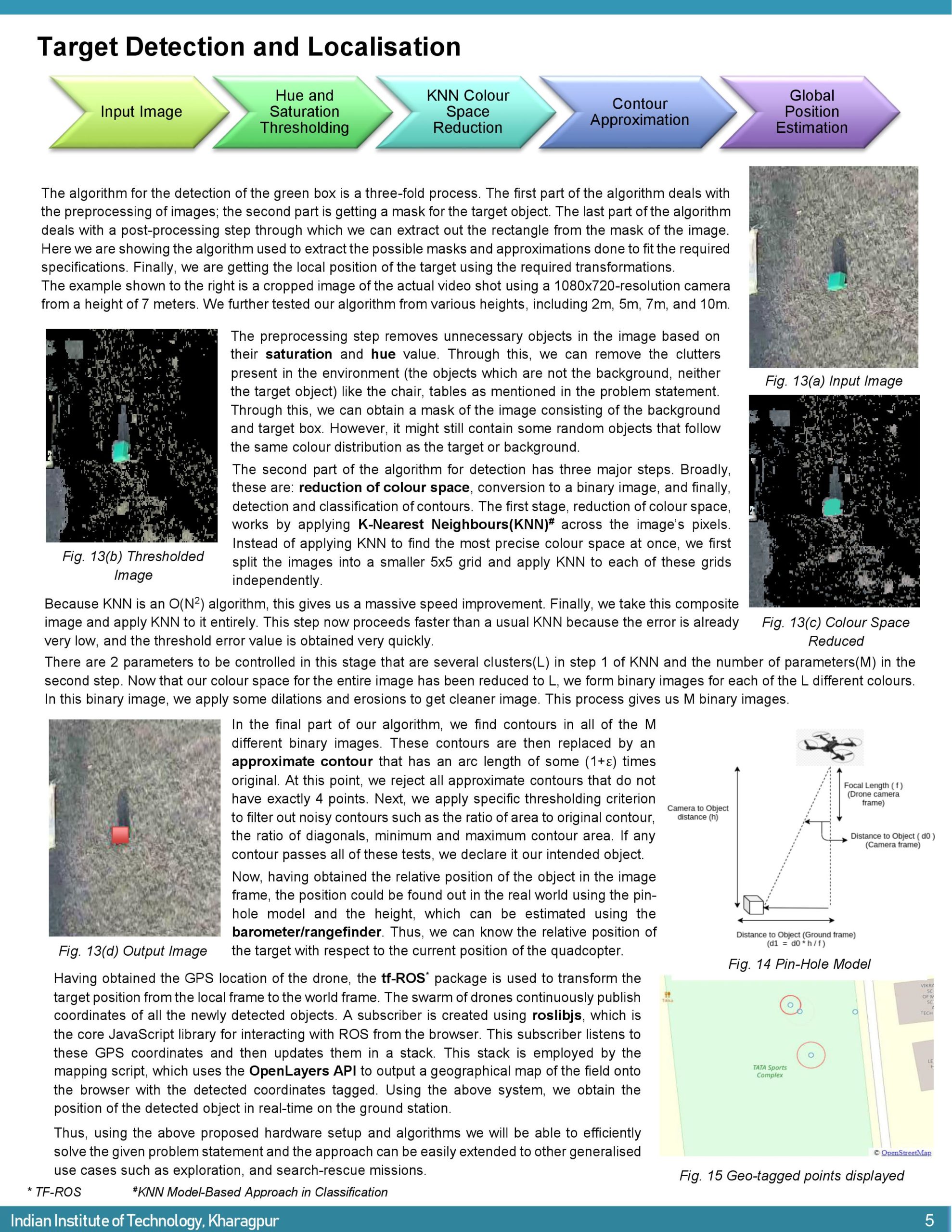
For understanding the overall approach and strategy refer to the 3rd and 4th Page of the Report uploaded above. SWARM Networking is explained on the 2nd, Detection and Integration of Map are explained in the 5th Page.
List of Packages Used : ROS, multimaster_fkie, MAVROS, OpenCV, Map API, ardupilot firmware and simulation stack.